

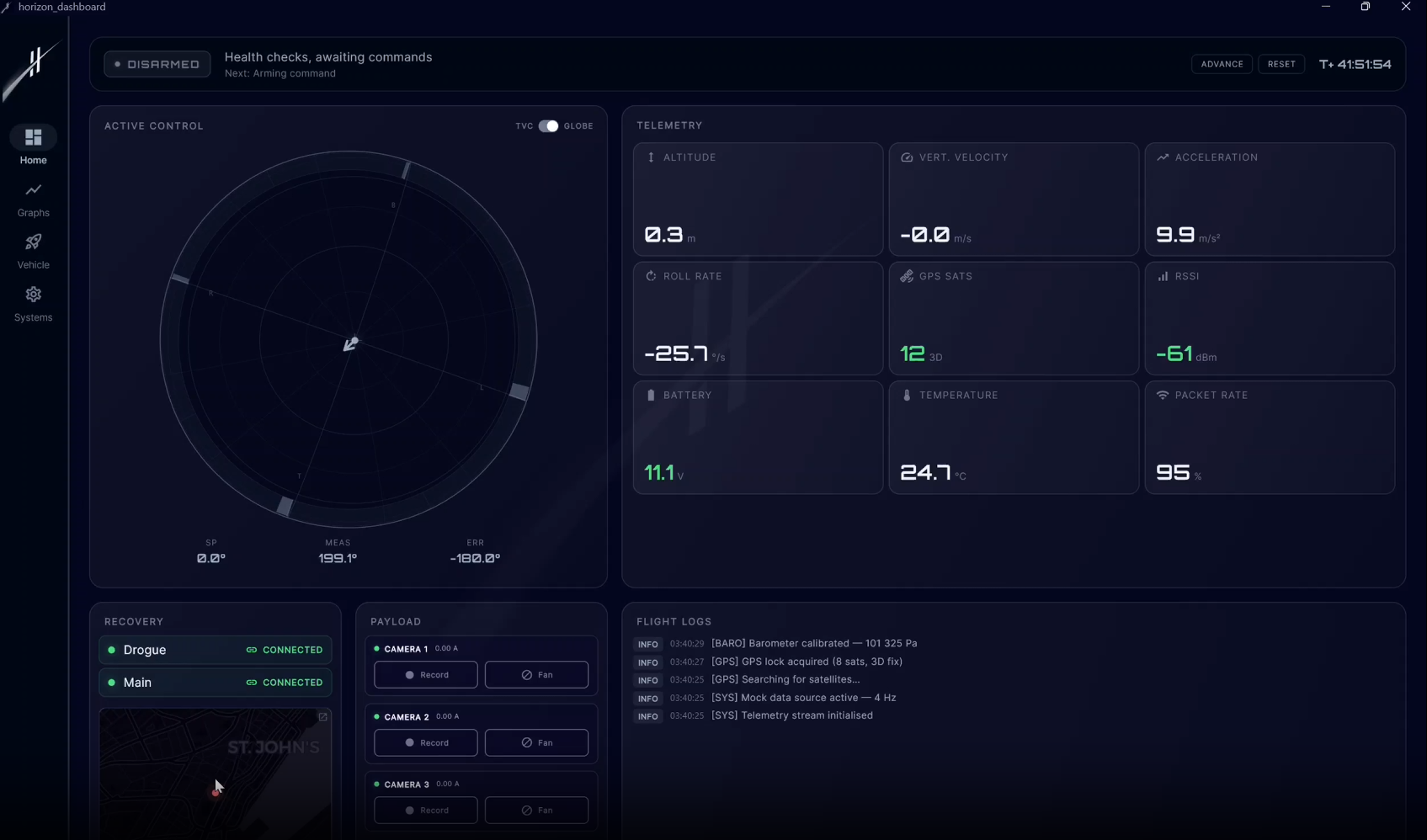
The Horizon Ground Dashboard is the mission control software I built this semester for our Horizon Aerospace rocket. It is the other half of the flight computer story: while the avionics fly the rocket, this dashboard is what the ground crew actually looks at during a launch. It handles live telemetry, plots flight data in real time, shows the rocket on a map, and gives the team a clear picture of what is happening in the air.
Why Flutter
I chose Flutter so the same codebase would run on whatever hardware happened to be available on launch day. The dashboard currently runs on Windows, macOS, and Linux without any platform-specific branches. That means a team member can open it on a personal laptop, or we can deploy it on a Raspberry Pi wired directly to an RFD900X long-range radio modem and carry that compact setup out to the field. No dedicated laptop required.
Real-Time Telemetry & Graphs
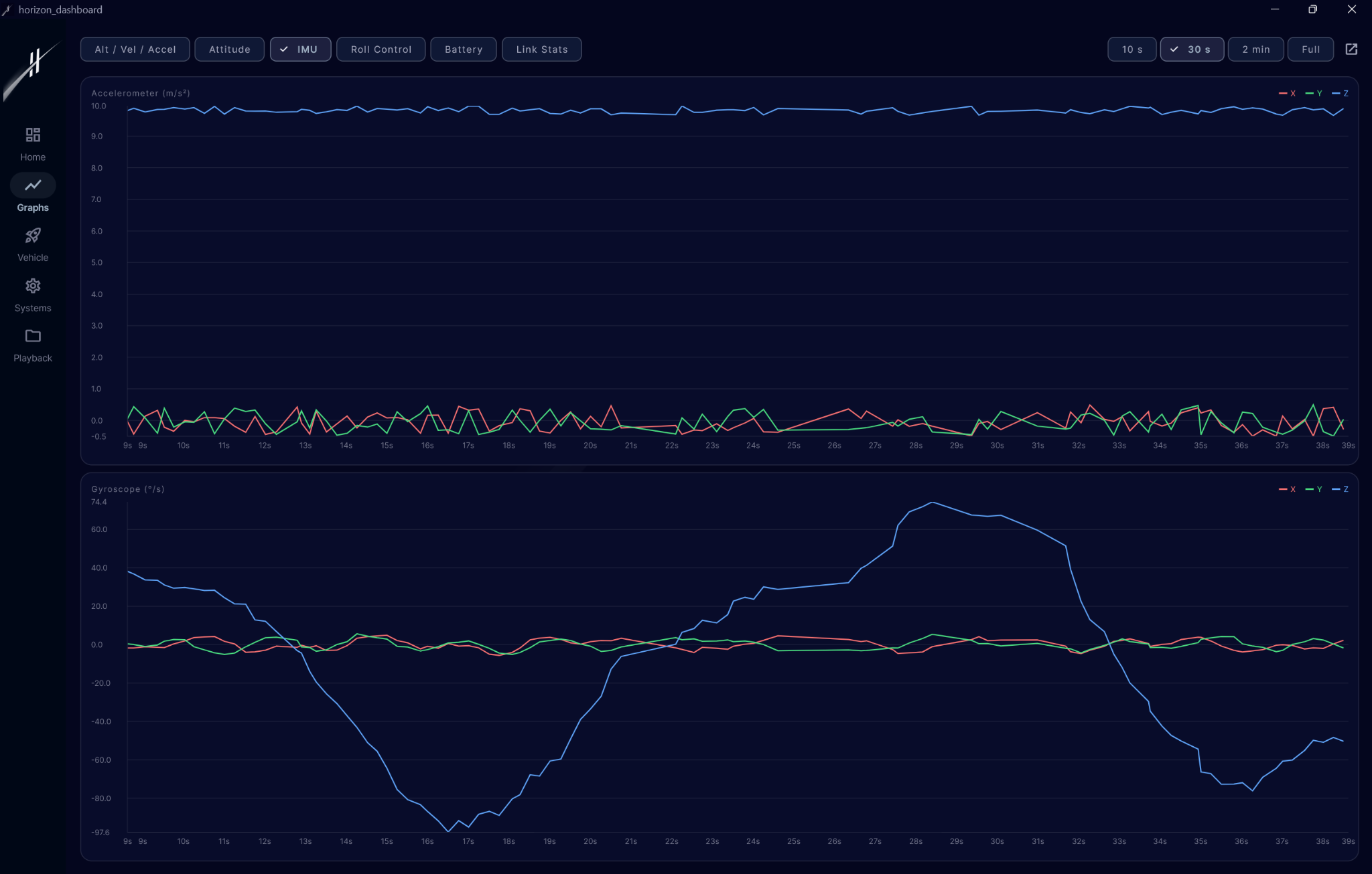
The dashboard ingests the downlinked telemetry stream and renders it as live graphs for altitude, velocity, orientation, battery, and sensor health. Everything updates at the rate the flight computer pushes it, so the team can spot anomalies as they happen rather than after the fact. Each plot is interactive, so the team can zoom into a specific window of the flight during post-launch review.
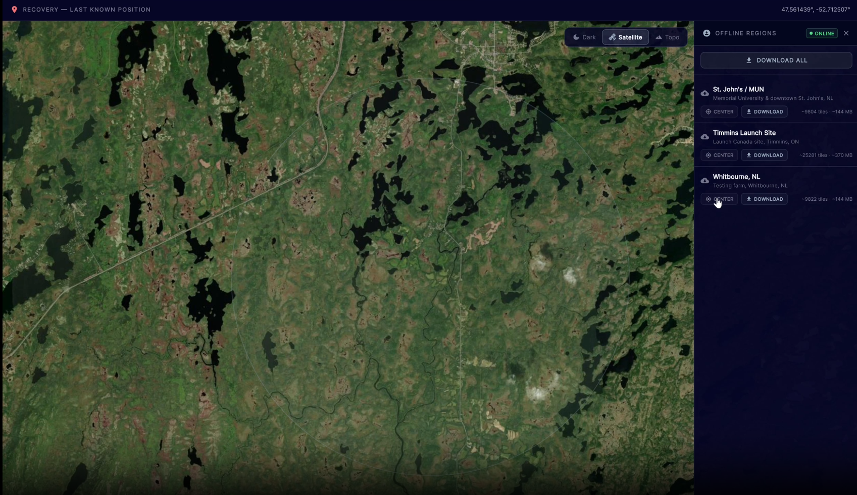
Mapping & Recovery
A dedicated map view tracks the rocket’s GPS position from launch through descent, plotting its full trajectory and projected landing area. The dashboard also acts as a local mesh network node, letting mobile devices hop onto it and share data back. On the phone side, a companion mobile client taps into the onboard sensors (GPS, compass, IMU) so the recovery crew can walk out into the bush with their phones and home in on the rocket using directional cues. It turns any team member’s phone into a recovery instrument.
Tech Stack
- Flutter + Dart for the desktop UI and cross-platform builds
- Serial + UDP transport layers for RFD900X radio and network links
- Raspberry Pi as the field-deployable target device
- fl_chart for the real-time plotting
- Flutter Map for GPS tracking and trajectory visualization
What I Took Away
This was the project where Flutter really clicked for me. Building a tool that needs to look good, handle a constant stream of live data, and run on wildly different hardware pushed me to think carefully about state management, isolates for the radio parser, and keeping the UI layer snappy even when the data pipeline is busy. It is also easily the most rewarding thing to watch in action, because the moment the rocket lifts off, every number on the screen starts moving.
Source
The full project is open source and lives on GitHub: Horizon-Aerospace/Dashboard. The repository is split across branches for each major feature so the history stays readable.